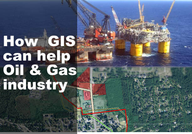
Applications of GIS in Oil and Gas Industry in Nigeria and Africa
Oil and Gas is an industry that fuels progress, development and basic human needs, the oil and gas industry is a vital part of Nigeria and other African Economies
The Oil and Gas industry in Nigeria and Africa as a whole is driven by an estimated 80% data that has a spatial component.
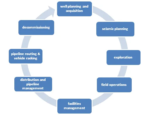
This is the only industry that harnesses spatial information at every stage of the life-cycle, beginning with opportunity analysis and exploration, through appraisal and production, right up to the abandonment phase.
Geographic Information System (GIS) in oil and gas industry is a rapidly growing field of interest. GIS applications in the oil and gas industry can serve multiple purpose.
Why use GIS in Oil and Gas/ Petroleum Industry in Nigeria and Africa as a whole
Oil and gas data is strongly connected to geography. For example, oil exploration, pipeline construction and the environment use Geographic Information System ( GIS ). All of these features are spatial in nature.
The applications of GIS in oil and gas industry can improve the cost-efficiency and deliver timely information.
There are different ways to apply GIS to oil and gas-related sectors. For example, you can use geodatabases, remote sensing, map automation, and more.
Oil and gas data sets are largely geographically based. For this reason, GIS can provide solutions for constructing pipelines, drilling oil wells, and environmental protection.

The benefit of GIS in the Petroleum industry
Pipeline monitoring
Pipelines need to be continually monitored to check for leaks, and geo-hazards, and to manage and track inspections, the frequency of which is often a regulatory requirement. An emerging use of GIS is in integrating the map with digital video, often acquired using remote vehicles on the seabed, enabling engineers to see sections of pipeline and monitor hazards affecting the installation.
Emergency response
GIS is becoming increasingly important in response to emergencies such as oil spills and gas explosions, both in mitigation planning and response management. Data loaded into a GIS can be made available to all stakeholders regardless of their physical location (e.g. to workers in the field on mobile devices), and even to the public. This leads to better decision making during emergency response situations, and improved public relations.
Asset Management
A geodatabase stores, collects and manages the physical locations of features. In oil and gas, this includes pipelines, wells, pump stations and tank terminals. But it also includes non-spatial information. For example, oil and gas companies are interested in leases, date of installation and pipe material. This can be useful to better understand when pipelines are in need of maintenance or repair.
GIS can be used to Control Pipeline Vandalism of Oil and Gas Industry in Nigeria
The oil and gas industry is an extremely important segment of the world economy. This industry is a major source of income for many countries of the world such as Saudi Arabia, Russia, China, Iraq Kuwait, Nigeria etc
In Nigeria, over the past decades, the pipelines with their associated rights of way have suffered sequences of acts of vandalism
A study by Research Journal of Information Technology in using GIS application in controlling petroleum pipeline vandalism in oil and gas industry of the study area (oil communities) of delta state has come up with lots of lessons which include, the ability of GIS tool to develop database showing all the layers used for the study from logical to physical database design. Another advantage is handling bulky dataset in the form of both spatial and attributes data. Furthermore, GIS tools demonstrated how a crime like vandalism can be analyzed by the use of various it tools like hotspots analysis, kernel density analysis, and buffer analysis were also used to show the photographs of the hottest spot locations of vandalism incidents in the study area
Field operations
An emerging use of GIS is in using flying sensor technology to gather on-demand high resolution imagery across a field location in order to survey a site. This allows companies to regularly monitor sites and to identify and manage change, without having to commission expensive satellite data capture.
GIS Automation in Map Production and Visualization
In environmental assessments, pipelines & pump stations, areas of historical oil and gas exploration and even directional drilling… There’s no better time and place to use a GIS for mapping out these features.
Pipeline routing
Building pipelines to carry petroleum products in Nigeria is capital-intensive, so determining the optimum route is critical. This is a non-trivial task that can be significantly simplified through the use of ‘least-cost path analysis’ – a process that identifies the route of least resistance between a source point and destination, based on the effort required to pass through cells in one or more cost raster datasets, such as slope (based on a DEM) and land-cover. Studies have shown that GIS-based least cost path analysis can produce more environmentally friendly routes, as well as reducing costs by up to 20%.